
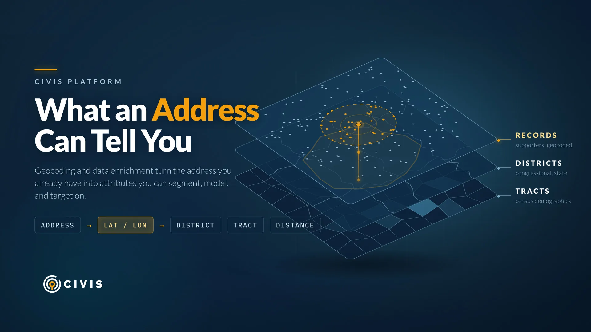
Most organizations know where their supporters live. Far fewer know what district those supporters vote in, what the household income looks like on their block, or which of them live within ten minutes of next Saturday's event.
That gap is what geocoding closes. Civis Platform converts street addresses into latitude and longitude coordinates, and coordinates are the key that unlocks everything else. Once a record has coordinates, you can join it against congressional districts, census tracts, and any other boundary you care about. The address you already have becomes a set of attributes you can segment, model, and target on.
Here is what that looks like in practice.
Tag every supporter with a political district
Political organizations run on districts. You need to know which Congressional district and state legislative district each person falls into, and voter file data will not cover everyone in your file. Supporters who came in through a petition, an event signup, or a donation form usually arrive with nothing but a name and an address.
Geocode those records and join them against district boundaries, and every person in your database gets a district assignment. Now you can size your list by district, find your supporters in competitive races, brief a field team on where the volunteers actually are, and report your reach to a board in terms they recognize.
District lines change. When they do, you re-run the join against the new boundaries rather than rebuilding your file from scratch.
Reach everyone in a specific area about a specific issue
An advocacy organization tracking a local issue, say a proposed facility, a city ordinance, or a state bill moving through committee, needs to reach the people the issue actually affects. That group is defined by geography, not by anything in your CRM.
With geocoded records you can define the area however the issue demands: a radius around a site, the boundaries of a legislative district, a set of ZIP codes, or a custom polygon your team draws. Pull the list, push it to your texting or email platform, and the message goes to people with a reason to care about it. Everyone else stays out of the send, which protects your opt-out rate and your credibility.
Fill in demographics you never collected
Most organizations collect a name, an email, and an address. They do not collect income, education, or household composition, and asking for it on a signup form is a good way to lose the signup.
Geocoded records can be appended with American Community Survey data at the block group or tract level, which gives you a picture of the neighborhoods your supporters live in: income distribution, educational attainment, housing tenure, population density. This is neighborhood-level context rather than a claim about any individual, but this level of information can prove to be predictive in modeling.
If your team builds modeling tables, geographic enrichment is some of the cheapest signals available. You already have the addresses. Appending census attributes costs you a pipeline step, and it gives your models something to work with beyond engagement history. Teams that are not modeling yet still get a clearer answer to a question every fundraising and program lead asks: who are our people, and where are they concentrated?
Find the people who live near an event
Event turnout falls off fast with distance. If you are hosting a canvass launch, a town hall, a clinic, or a training, the people most likely to show up are the ones who live nearby.
Coordinates let you calculate distance directly. Pull everyone within a few miles of the venue, invite them first, and hold the wider send for later. The same calculation applies to service delivery: nonprofits running clinics or distribution sites can measure how far clients travel, spot the neighborhoods with the longest trips, and use that to decide where the next location should go.
Getting the addresses right first
Enrichment is only as good as the geocoding, and geocoding is only as good as the input addresses. Addresses collected in the field and through online forms arrive in every possible format. Apartment numbers land in the street line. "Street" shows up as St, St., and Street in the same file. Typos are constant.
Civis Platform includes address standardization that normalizes addresses to a consistent format before geocoding, which measurably improves match rates. If you are working with supporter data collected over several years from multiple sources, standardization is the step that makes the rest of it work.
People also move. National Change of Address (NCOA) processing matches your file against the USPS database of filed address changes, so records point to where people live now rather than where they lived when they signed up. Civis can run your data through NCOA and return updated addresses, which you then geocode for current coordinates. Run it on a schedule and your file stays current without anyone thinking about it.
The geocoder returns match quality alongside the coordinates. Strong matches resolve to the rooftop. Weaker ones fall back to a street segment or a ZIP centroid when the exact address cannot be pinpointed, which matters when you are deciding whether a record is precise enough for a tight radius pull. The geocoder is included with Civis Platform, so there is no separate vendor to contract with or per-record fee to track.
Build it into your pipeline
This works best when it runs on its own. Configure a workflow that standardizes addresses, applies NCOA updates, and geocodes new and updated records on a regular basis. Store the coordinates and appended attributes alongside the rest of your supporter data in your Civis data warehouse.
Analysts then get district, demographic, and distance fields as ordinary columns. Building a district-level count or a radius pull becomes a query rather than a project, and if you do want to put the data in front of people visually, the coordinates are ready for whatever mapping or BI tool your team already uses.
Getting started
Civis customers can start today. Reach out to our support team to configure geocoding jobs and integrate them into your existing pipelines, including address standardization and NCOA processing.
Not on Civis yet? Schedule a demo and we will show you what your address data is already capable of telling you.