
The Power of Maps: Geocoding and Data Enrichment in Civis Platform
Maps are one of the most powerful tools in advocacy work. When you can see where your supporters live, where services are lacking, and where resources need to be directed, you can make better decisions about where to focus your efforts. But to put your data on a map, you first need coordinates. That's where geocoding comes in.
Civis Platform includes a geocoder that transforms street addresses into latitude and longitude coordinates, unlocking a range of analytical capabilities. Once your records have coordinates, you can visualize them on maps, aggregate them into geographies, and enrich them with information about the places where people live.
Starting with Clean Addresses
Before you can geocode, you need addresses that a geocoder can actually parse. Addresses collected in the field or through online forms come in all sorts of formats. Some have apartment numbers jammed into the street line. Others abbreviate "Street" as "St" or "St." or spell it out entirely. Typos are common.
Civis Platform includes address standardization tools that normalize addresses to a consistent format. Standardized addresses match more reliably against reference data and produce higher-quality geocoding results. If you're working with supporter data collected over years from multiple sources, running it through address standardization before geocoding will significantly improve your match rates.
Keeping Addresses Current with NCOA
People move. The address you collected two years ago may no longer be valid. Mailing to outdated addresses wastes resources, and more importantly, you lose contact with supporters who want to hear from you.
National Change of Address (NCOA) processing matches your addresses against the USPS database of filed address changes. When someone submits a change of address form with the postal service, NCOA lets you update your records to reflect their new location. Running NCOA regularly keeps your data fresh and your outreach effective.
Civis can process your data through NCOA and return updated addresses, which you can then geocode to get current coordinates for your supporters.
Geocoding Your Data
With clean, current addresses in hand, you can geocode. The Civis geocoder takes an address and returns latitude and longitude coordinates along with information about match quality. High-confidence matches give you precise rooftop-level coordinates. Lower-confidence matches might resolve to a ZIP centroid or street segment when the exact address can't be pinpointed.
The geocoder is included with Civis Platform, so there's no additional cost or third-party service to manage. You can geocode records in batch as part of your data pipelines, running nightly jobs that process new records as they come in.
What Coordinates Unlock
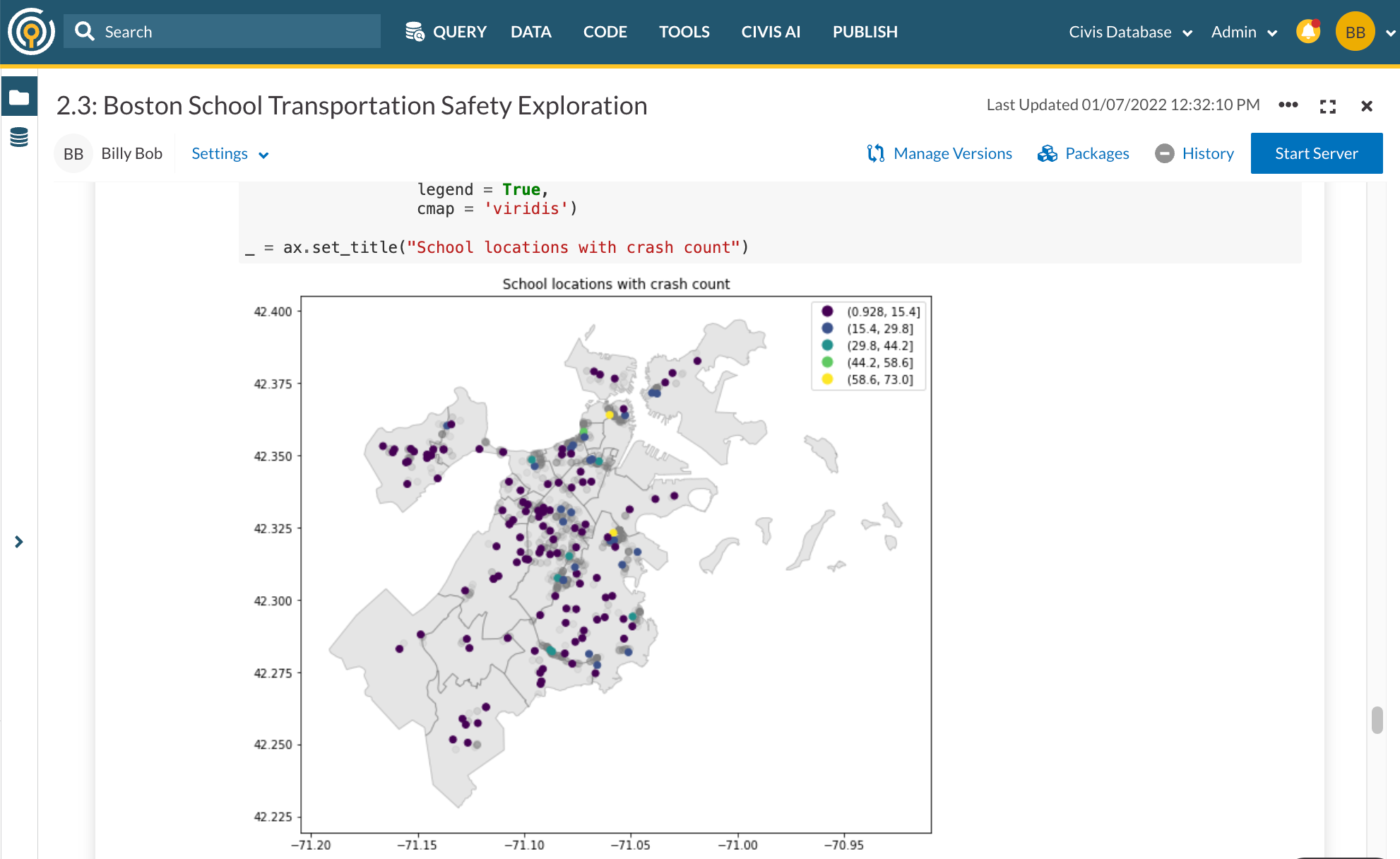
Once your records have coordinates, the real analytical power begins. You can join your data against geographic boundaries to append contextual information about where people live.
Census data. Append demographic information from the American Community Survey at the block group or tract level. Understand the income levels, educational attainment, housing characteristics, and population density of the areas where your supporters live.
Political districts. Determine which Congressional district, state legislative district, city council district, or precinct each person falls within. Target outreach by district, identify supporters in competitive races, or analyze your reach across different political geographies.
School districts. For education-focused advocacy, knowing which school district someone lives in lets you connect them with relevant local issues and mobilize them for school board elections or policy campaigns.
Custom geographies. If your organization has defined its own service areas, chapters, or regions, you can join geocoded records against those boundaries to assign people to the right organizational units.
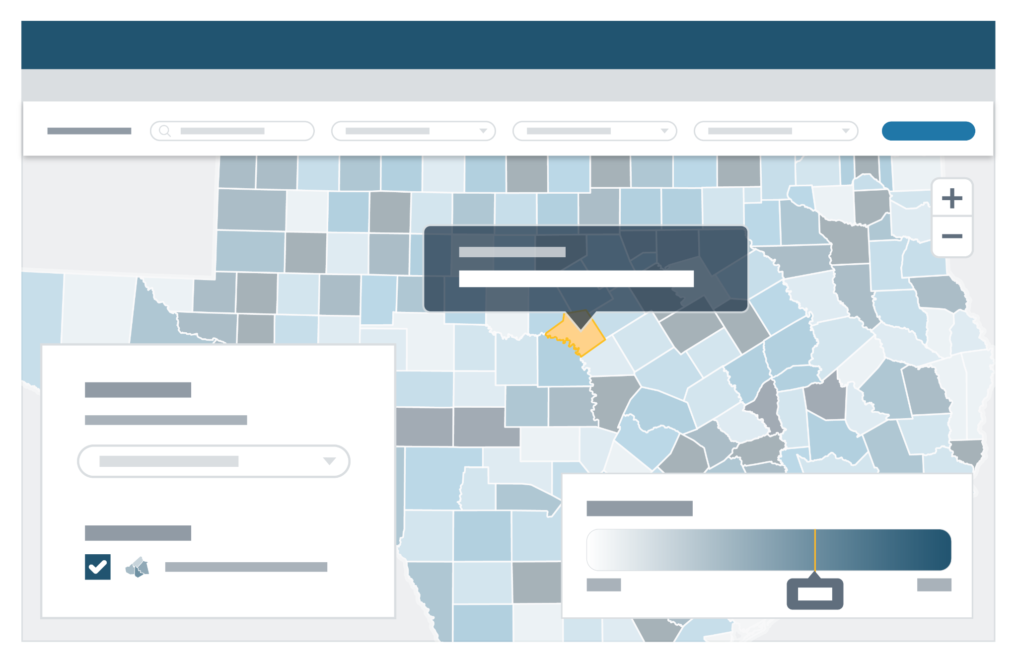
Mapping for Advocacy Insights
With geocoded and enriched data, you can build maps that reveal patterns and inform strategy.
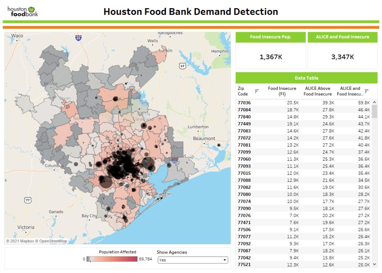
Food access. Identify where residents live far from grocery stores, highlighting food deserts where communities lack access to fresh, healthy food. Advocacy organizations working on food security can use these maps to prioritize investment and policy efforts.
Voter access. Map the distance between registered voters and their assigned polling locations. Long distances or lack of public transit can suppress turnout. Understanding these patterns helps campaigns plan ride-to-the-polls programs and advocate for additional early voting sites.
Environmental justice. Overlay your supporter data with environmental hazard data to identify at-risk individuals living near pollution sources, Superfund sites, or industrial facilities. Environmental advocacy groups can use this analysis to target outreach and build coalitions in affected communities.
Service delivery. Nonprofits providing direct services can map client locations against facility locations to understand travel burdens and identify gaps in coverage. This analysis can inform decisions about where to open new locations or deploy mobile services.
Building Geocoding into Your Pipelines
Geocoding works best when it runs automatically as part of your data infrastructure. Configure a workflow that standardizes addresses, runs NCOA updates on a regular schedule, and geocodes new or updated records nightly. Your analysts always have current coordinates to work with, and your maps stay up to date without manual intervention.
Store coordinates alongside your other supporter data in your Civis data warehouse. When you need to build a map or run a geographic analysis, the data is ready.
Getting Started
If you're already a Civis customer, you can start geocoding today. Reach out to our support team to learn how to configure geocoding jobs and integrate them into your existing pipelines. We can also help you set up address standardization and NCOA processing to ensure you're getting the best possible results.
Not yet on Civis? We'd love to show you how Platform can help you unlock the power of location data. Reach out to schedule a demo.
When you can see your data on a map, you can see where the work needs to happen.